Showing posts with label urban wilds. Show all posts

Monday, January 19, 2015

The Bleak Midwinter and a Walk Around the Pond at Dusk

Our nearly snow-less winter continues.  However, that has not meant that the cold hasn't invaded our fair city (Cambridge, MA).  The Charles River is frozen.  And so is Fresh Pond.

The bleak midwinter without snow is especially bleak.  The cold keeps one from lingering and there is little to see in the snowless, barren landscape.  Hope is hard to find.

Today is the celebration of Martin Luther King, the holiday to honor the vision and hope he brought to the struggle for equal rights and equal recognition.  There was the usual services, inspirational speeches and, this year, a demonstration in Boston.  Time has past, but the hoped for vision is not fully realized.  At times, we're still two nations, not fully understanding each other.  At times, we're still in the bleak midwinter of relations and understanding.

Back in Cambridge at the end of the day, the three of us took a brisk walk around Fresh Pond in the gathering darkness of the dusk of a bleak, but snow-less, mid-winter's day.  It was cold.  But if you keep moving, it was ok.

In the bleak midwinter, hope can be found if you keep moving ahead.

The setting sun casts its orange light on the Ringe Towers trio across the frozen pond.

Dusk in the west beyond the hill of Kingsley Park.

The abandoned track of the Watertown Branch of the once Boston & Maine Railroad passes the west side of the pond.

Little Fresh Pond is frozen over.  In warmer weather, it is a favorite spot for dogs to take a quick swim.

The last light of the day reflects off the ice.


Sunday, July 7, 2013

Deer Island: Urban Wilds, Harbor Views and a Treatment Plant

A few weeks ago, one of my sobrinas (a niece on the Peruvian side of the family) who is also an engineer paid us a visit.  Where to take her?  On a tour of her tia's engineering projects, where else!

After picking her up at Boston's Logan Airport, we took a short drive to Deer Island, which includes some of my projects from the 1990s when the island went through a major decade-long reconstruction.

Historically, the isle was home to the outcast, from a hospital to treat the incoming refugees from the Irish Potato Famine to a prison as well as the city's wastewater treatment plant.  It was not a place to visit!

In the remake of Deer Island, an
urban wild was created to buffer the
wastewater treatment plan.
The 1990s saw an extreme make-over of Deer Island.  The state of Massachusetts was under a court order to clean up Boston Harbor and end the dumping of partially treated (i.e., primary treated) sewage just off the tip of the island.  A brand new treatment plant would replace the prison and old plant.  To hide the facility from the nearby residents in Winthrop, they would take the drumlin (glacially-deposited hill) in the middle of the island and move it to the north side, creating an urban wild to buffer the plant.

The public access plan we developed
called for full-perimeter public access.
This section, designed by a different
firm, shows the perimeter walkway
above the 8-ton revetment that
protects the shoreline.
Many of us civil engineers worked on various facets of the treatment plant and surroundings.  My work was to manage a bit of the design of part of the plant, but mostly involved the sitework in and around the various structures.  While much of the work was utilities buried in the ground, the public access plan and shoreline protection are what is most visible to the visiting public.

The public access plan we developed called for full-perimeter public access.  The views are spectacular:

  • To the east is Massachusetts Bay and the outer harbor islands.  
  • To the west is Boston Harbor, the inner islands, the Boston skyline and Logan Airport.  

A previous effort by another firm said this was not feasible near the marine facility (dock and pier), but our plan moved the pathway landward so as to keep the public away from the hazardous area.

The western shoreline protection at
Deer Island was the product of  a
design that I managed.
I was design manager for two major sitework con-tracts.  The  shoreline pro-tection shown above on the right was designed by another firm, but included in the first of these con-tracts.  In the second con-tract, the western shore-line protection (see photo at left) was the product of our design work.  Along each of these shorelines, public pathways (see photo above) were designed by another firm and build in a subsequent sitework contract.

With With great views from the top of the new drumlin, the design of the buffer included a series of pathways up and around.  The photos below will give you a tour of the urban wilds and the vistas available to the public


Pathways circle and climb the buffering drumlin on the north side of Deer
Island.  The following photos illustrate the views from the pathways.


Large meadow in a nook of the new drumlin, with views of Spectacle and
Thompson Islands and Dorchester on the mainland beyond.

View to the north shows the silhouette of the Town of Winthrop.

Two views of the new treatment plan.  In the view on the right, Long
Island  is visible in the background.

Overview of the treatment plant:  from the foreground is the secondary
clarifires, then the aerobic and anaerobic selectors,  the primary clarifiers,
the grit removal facilities, with the egg-shaped sludge digesters in the
background.

Only 2 miles from Logan Airport, a plane is on a landing pattern over the
nearby Town of Winthrop.

Also visible is the skyline of Boston, only about 4 miles away.

With the dusk settling in, we left Deer Island on the one access road
(designed  by the author!)

Wednesday, October 27, 2010

Byways in the Fall

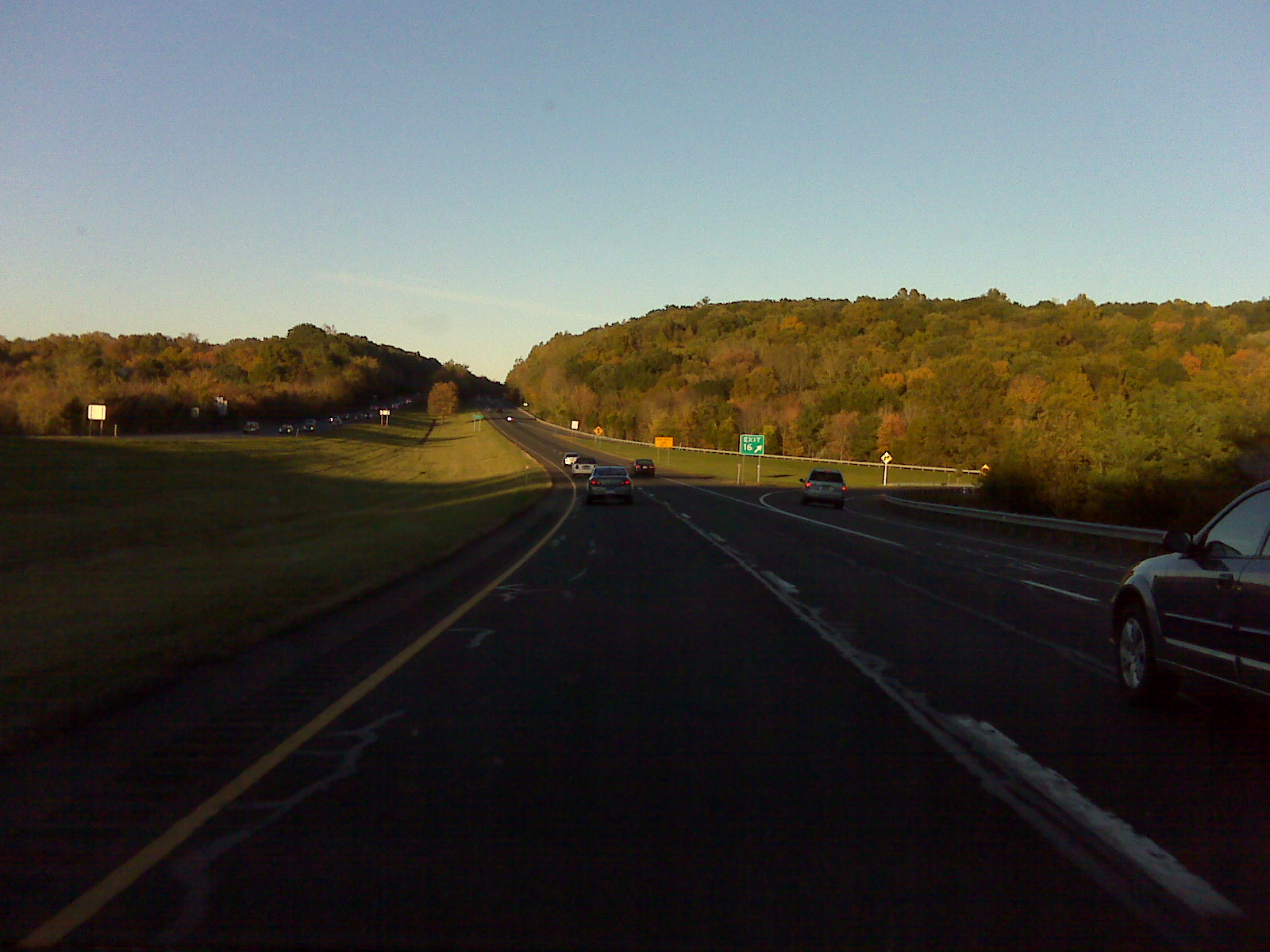
One of my favorite contexts to view the bright colors of the fall foliage is in the linear context of byways, be they pathways, streets, or highways. Following are a few of the views I captured early during that period when the early hints of color mix with summer greens.

Below: Returning home from New York in early October, just a touch of fall colors tinge the wooded hillsides along Interstate 84 in Connecticut
Below: A mix of fall color lines the pathway in the urban wilds near Belle Isle Marsh in Winthrop.
Below: Early colors in the mature canopy along the pathways of Boston's Public Garden.

Below: Sun streaking through the foliage above a country lane in the midst of urban Cambridge.

Below: A fall view along a path on the campus of Stonehill College in Easton, Massachusetts

Sunday, January 24, 2010

Urban Wilds: The Wilderness Around A Frozen Fresh Pond

Even within the city, one can find wilderness views that evoke a more rural setting than where you are standing. Fresh Pond is in the western extent of Cambridge and part of the water supply system. A hundred years ago, ice was harvested in winter and shipped around the world. Today, the pond itself is fenced off, but its perimeter contains a fringe of urban winderness, a small wild in the midst of the city.

. Below: A gatehose on the shoreline


Below: The only open water in the otherwise frozed solid pond.


Below: Tracks run through it -- a rail line through the woods next to the pond.


Below: red berries add color to the snow covered landscape.


Below: Reeds mark the snow-covered shoreline.


Below: Sun setting peeking through the pondside woodlands.